Into the Woods: Home

Carving out time for hiking, valued though it is, often takes quite the effort. Because of this, I am always very grateful for the Lookout Mountain segment of Chickamauga and Chattanooga National Military Park. When you have 3 hours for a hike, 30 minutes (round trip) in the car and 2-and-a-half hours on trail is far preferable to driving a long way for a short walk.

In thick irony, all of the peaceful parkland around our city is only here because the violent deaths of several thousand men on these grounds in 1863. There is room for reflection there (of which more another time) which does not go unnoticed, but we locals love the battlefields for the 9,000+ acres of public land they afford. My kids are growing up with this heritage, and they already probably think it’s odd that you don’t have cannons all over the place where you live.

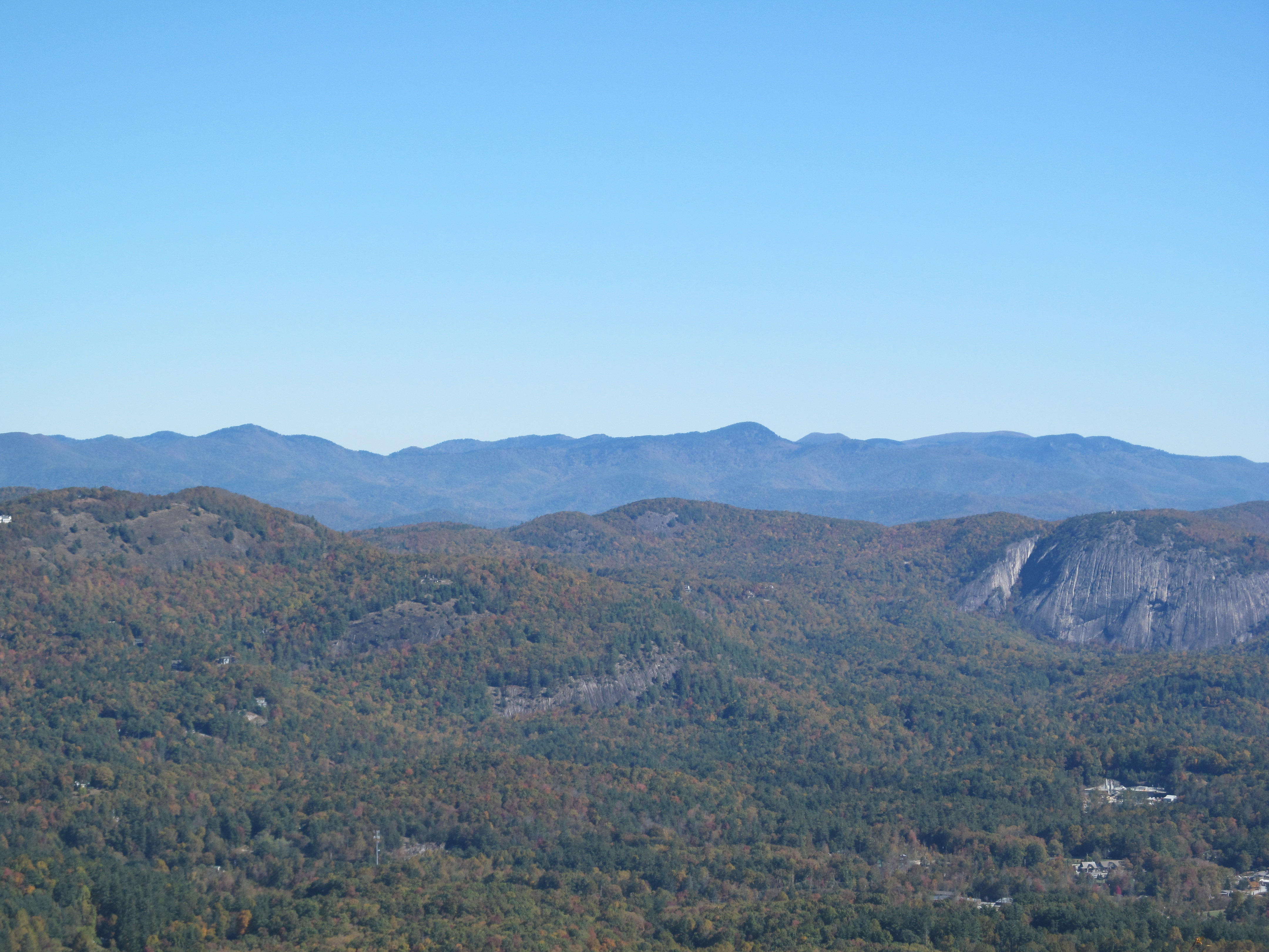
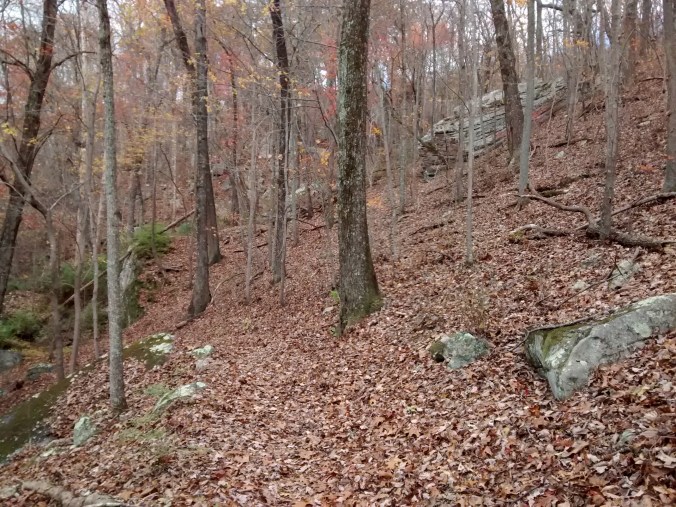
I’ve trod many a mile around this old mountain, handy as it is (much of it  within Chattanooga’s city limits). Trucks and trains rumble just beyond the park’s edge, and there are two fully functioning towns (Both conveniently named Lookout Mountain—one in Tennessee, one in Georgia) atop the plateau, but the trails quickly open to mature forest.

Yesterday, Rachel & the older two girls had a birthday party to attend, so I “volunteered” (read: begged) to watch the youngest and spare us the experience. It was nice out (this fall as been terribly warm), so we decided to head for the woods.

IMG_20151121_140059118

Selfies are not my forté, but at least toddlers in backpacks are cute.

We parked over on the west side of the mountain off Wauhatchie Pike  (near the Chattanooga Nature Center), to go upslope via the Kiddie trail (named for someone, not made for kids)/Skyuka Springs Trail/Gum Springs Trail. Time (and the limited patience of strapped-in children) kept us from making it all the way to Sunset Rock, but we were headed in that general direction.

IMG_20151121_142107786

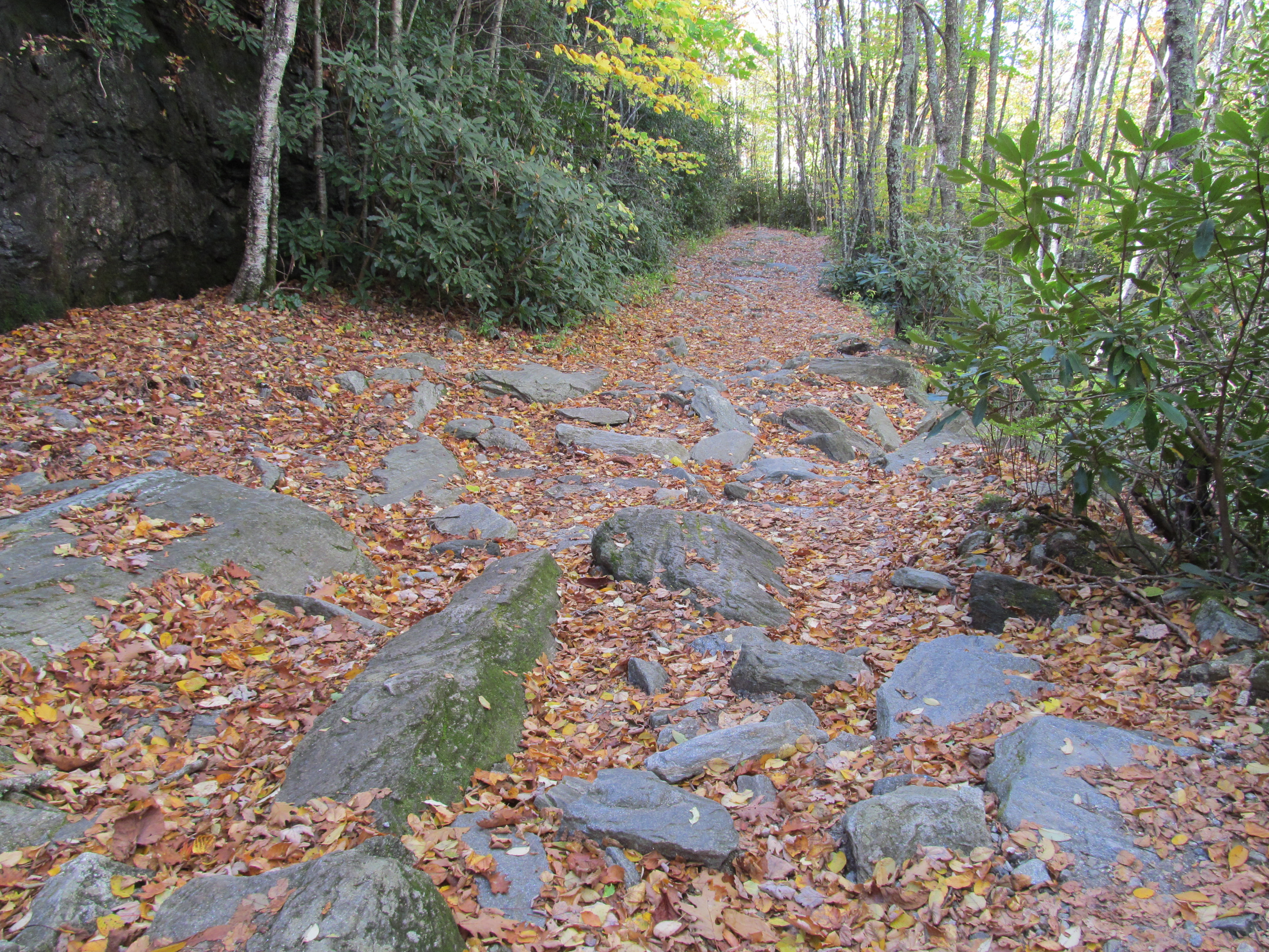
Kiddie is not terribly scenic, just a steep access path into the rest of trail network. A number of downed trees (probably dating from a bad tornado outbreak a few years ago) left the canopy spotty enough that the lower trail is rather overgrown and weedy.

IMG_20151121_141125581

Further up, there were still a few fall colors poking through, and plenty of the usual Cumberland Plateau scenery (boulders, oaks, streams, etc.).

IMG_20151121_140822190

IMG_20151121_142451637

IMG_20151121_143303146

IMG_20151121_145933501_HDR

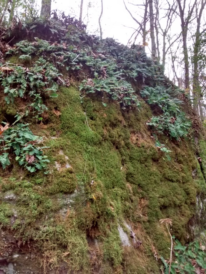
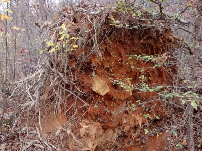
As an aside, this area always makes for some interesting plant finds (like the Japanese burning bush shown below). Homeowners on the brow of the mountain above must toss their yard waste over the cliffs, and enterprising seeds and shoots take root in the woods below. A lot of what you see growing down there does not “belong”.

IMG_20151121_144342634

A few miles of foot-pounding does a body (and soul) good, but I’m not certain my passenger felt the same. She didn’t cry, though she did hold on to my shoulder for most of the ride; for her first time in the backpack, I suppose she thought she was “floating” behind my head and not entirely confident of her situation. It’s the price you pay for being my kid, I guess.

IMG_20151121_143333157

Into the Woods: Southwest NC

This fall has been one of the busiest seasons of our lives. Both Rachel and I are deeply committed on a number of levels, running on wisps of sleep and doing what we can to keep the plates spinning.

In the midst of it all, though, we were blessed to have a long weekend to ourselves (yes, her parents kept all three kids. Thanks!) to celebrate 9 years of marriage.

We got married in October at least partly because of the color scheme, capping off the wedding with a honeymoon in Downeast Maine back in 2006. Ever since, we’ve enjoyed timing our anniversary travel with peak foliage wherever we go to celebrate. We hit the weather/color jackpot again this year with a trip over to the Highlands/Cashiers area of North Carolina.

I grew up in the mountains of North Carolina, but never spent much time in the southwest corner of the state. We had plenty of opportunity to enjoy the sights there this month, though, and we hit the trail. Rachel hasn’t always shared my love of grueling hikes, but we both do enjoy being outside. She let me drag her up and down a number of hills on this jaunt, and I’m pretty sure she even enjoyed herself.

What a treat. I’ll let the photos speak for themselves.

IMG_4339

The hill behind our condo at Sapphire Valley.

IMG_4355

Whitewater Falls

IMG_4391IMG_4394IMG_4401IMG_4415IMG_4407IMG_4409

Several shots from Black Balsam Knob off the Blue Ridge Parkway. Rachel tells me I should just shout “Balsam” whenever I get stressed and think about this day up there.

IMG_4442IMG_4435

Graveyard Fields/Yellowstone Prong Falls is a one-in-a-million spot…unfortunately everyone knows it. We were tripping over other visitors, even on a Monday.

IMG_4493

We took this one from a Canoe on a rather windy lake.

IMG_4509IMG_4519IMG_4524IMG_4530

Whiteside Mountain in Highlands is something to behold. Quite a variety of terrain and views on a moderate 2.5 mile loop.

IMG_4540

Dry Falls on US 64.

Yep, I think I’ll keep her. =)

Into the Woods: Rocky Top

Plenty of folks will tolerate walking a few miles over rough terrain for exercise, camping, to see a view, or to enjoy a particularly nice day, but not many of us enjoy the walking itself.

Owen, a good friend of ours going back to college days, now lives “over the mountains” from us in Waynesville, North Carolina. He’s an avid hiker and backpacker (since moving to NC, he has logged some serious miles), and it dawned on both of us a few years ago that we were each other’s only friend who enjoyed hiking on its own merits.  That being the case, we’ve tried to get together at least once a year for a good stretch of the legs somewhere more or less equidistant from each of us.

In 2013, when the idea first came to fruition, I was staying at my parents’ home for a week in July, so we met to tackle Linville Gorge in North Carolina. We took two cars, parking one on the west side of the gorge and starting the hike from the east rim. We climbed up Hawksbill, and then promptly lost the trail on our way to the canyon floor (USFS Wilderness areas are [in]famous for non-existent trail maintenance and sparse signage). After a long scramble down the mountainside (you can only ever get so lost in a steep river valley), we picked up another trail and found the one footbridge across the river washed out. Not to be thwarted, we swam it, snakes and all. My friend went first; I tossed across our packs, and then dove in myself. We managed to dry off on the hot climb up the west rim, making it back to the other car minutes before a huge hail storm hit. Year 1: success.

In May of 2014, we conned another of our college buddies to join us for a 12-mile round trip in my neck of the woods: climbing Big Frog on the Benton MacKaye Trail. This time we got together the night before for some “comfort camping” out of the back of the car with good food and campfire conversations. We hit the trail in the morning, and had gotten about 200 yards into the woods when it started raining. Hard. No matter, though; it only lasted until we made it to the summit. We laughed, dried off as we made the long descent, and cured the misery with a burger on the way home. Year 2: comically good memories.

This month, ever gluttons for punishment, we chose to Thunderhead Mountain - Google Mapstry our hand at Rocky Top in the Northwest Quadrant of Great Smoky Mountains National Park. It’s a grueling climb by Eastern U.S. standards, with the shortest route (Lead Cove Trail > Bote Mountain Trail > Appalachian Trail) gaining 3,500+ feet in altitude over less than 6 miles.

We camped on a Friday at Cades Cove (word to the wise, if you want a weekend campsite there, book it well in advance). A sunset drive around the loop did not disappoint, with deer and coyotes showing off like they were on the NPS payroll. It was quite hot, but a small price to pay for a 0% chance of rain for hike day.

We woke with the sun, got packed and set to work on breakfast over the fire. It only took half of my first cup of coffee to call the weatherman’s bluff. It poured rain for about 10 minutes. Then the sun came out. As we were washing up the dishes and dousing the fire the same cycle happened again. Not a good sign.

We got to the trailhead, and the ground was dry, so we struck out. The humidity made for a sweaty and foggy ascent, but it did not rain. We passed some incredible trees (the north face of the Smokies is renowned for its old-growth tulip poplars and raIMG_3919inforest-like climate), a few wild hog “wallers”, an enormous tom turkey, and a hundred different kinds of flowers I planned to photograph on the more leisurely hike back. When we finally made it to the summit, the promised view was obscured by 50′ visibility in a bright cloud. We rested for a few minutes in hopes it would break, but gave up pretty quickly.

Not a quarter mile down the return trail, it began to rain steadily. We put on  our rain gear and trudged on. The farther we went, the harder it came down, thunder reverberating through the hollows. By the time we started the steepest part of the descent, the trail was nearly ankle deep in fast-moving runoff. At this point, you have to either laugh or cry; you don’t have a choice but to keep going.

Once we were within striking distance of our cars, the sun broke through. When we were almost dry, another storm came up with incredible speed, thoroughly re-soaking us for the last mile. All the planned photography was scrapped, so I have little to show from the hike but a good story to tell. A towel, dry shirt, and some tourist-priced (though happily not tourist-quality) smoked chicken at a riverside BBQ joint in Townsend offered just enough relief to recognize this insanity for the fun it is.

Year 3: If at first you get rained out, maybe summer hikes are not for you. How about fall or winter next time?

IMG_3914

Into the Woods: Domestic Appalachia

Even as a lifelong Southerner, I wilt at the first signs of the heat & humidity our region is famous for. Fear not: there is an out.

When I was 14, our family managed to settle in the one place where Southeastern culture intersects Northeastern weather–the High Country of Western North Carolina. That July day we pulled out from the little Georgia town that had been home for the previous 9 years, it was 107 degrees. In our new driveway (500 miles later and 3,800 feet up),  it was a heavenly 62. Thanks to that move, I grew up with barbecue and blizzards, sweet tea and skiing, fried okra and fresh air.

After college, the need for employment opportunities and affordable living led to putting down roots in my wife’s hometown of Chattanooga (where we still live and which we still love). When days start nudging past 80, though, my thoughts head for the hills. Thanks to my folks’ ongoing homestead (they built a house in 2006 on 23 acres “down in the valley”, at 3,300 ft. in Deep Gap), we can act on that impulse and be feet-up in the front porch hammock in five hours’ drive.

The older two girls and I made one of our escapes from summer this weekend and were handsomely rewarded with perfect weather and the full array of spring flowers. Our kids don’t know yet just how blessed they are to have access to this as a routine part of life, but they do know how much they love to visit Grandaddy and B-Ma any time of the year.

Plants hold a special place in my heart, so visiting home means I also get to visit some amazing plants (weird perhaps, but we’re all a bit off at some level or another). I worked four summers at a nursery and landscaping business during college. One of the perks was getting all manner of amazing plants at a steep discount. When my parents built their house, they asked me (and my employee discount) to do the initial landscaping. Whenever we go back to visit, I love seeing how those few trees, shrubs, and perennials have filled in over the past 9 years (owing much more to my mom & dad’s ceaseless care than any work I did in picking and planting them). As they’ve grown in, covering the bright red fill dirt that first surrounded their place, the house looks more and more like it’s always been there in that little bowl.

This series is supposed  to be about hikes and assorted adventures in the wilderness, but sometimes a trip “into the woods” feels a lot like home. There will always be more to say about the vast beauty of the Appalachians, and people with more time on their hands than me have written and photographed enough to document every good hike around. This little corner of the world is all ours, though.

IMG_20150525_131449776

A little corner of rhododendron varietals

IMG_20150525_131458644

You can seriously grow everything up there…

IMG_20150524_163611869

Mountain Laurel are everywhere

IMG_20150524_163143391

Lupine is an old favorite

IMG_20150524_163533542

They have several patches of Pink Lady’s Slipper around the land

IMG_20150525_151403186

Even the weeds are pretty: Cow Parsnip

IMG_20150525_151028114

And so are the grasses…

IMG_20150524_165422019

This Bigleaf Magnolia (not native to high altitudes) moved with me twice, but it seems to be thriving in the last place I planted it…20′ tall and about to bloom

IMG_20150524_164103612

The creek bottom down the hill from the house is covered with Skunk Cabbage and Cinnamon Fern