Into the Woods: Snake Mountain

When my family moved to North Carolina, in the summer of 1998, I was fourteen with an endless imagination for the adventures these hazy blue mountains would hold for an erstwhile Georgia flatlander. I moved away after a short while (to Dayton, Tenn., for college in 2002, and I’ve lived in Chattanooga since 2006), but these hills have always felt like home. Fortunately, my parents still live in the same county, so I get to come back and stay often.

Of all the mountains, perhaps none captured my fancy quite like Snake Mountain. It was due north from the back deck of the house we first lived in up there, its silent, volcano-like visage staring at me every morning. Unlike many other peaks around the area, it was also inaccessible—private property with no marked trail or easy access to its 5,555′ rock-strewn summit.

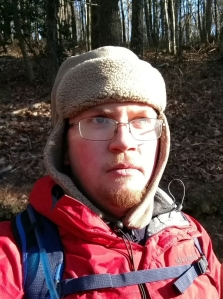
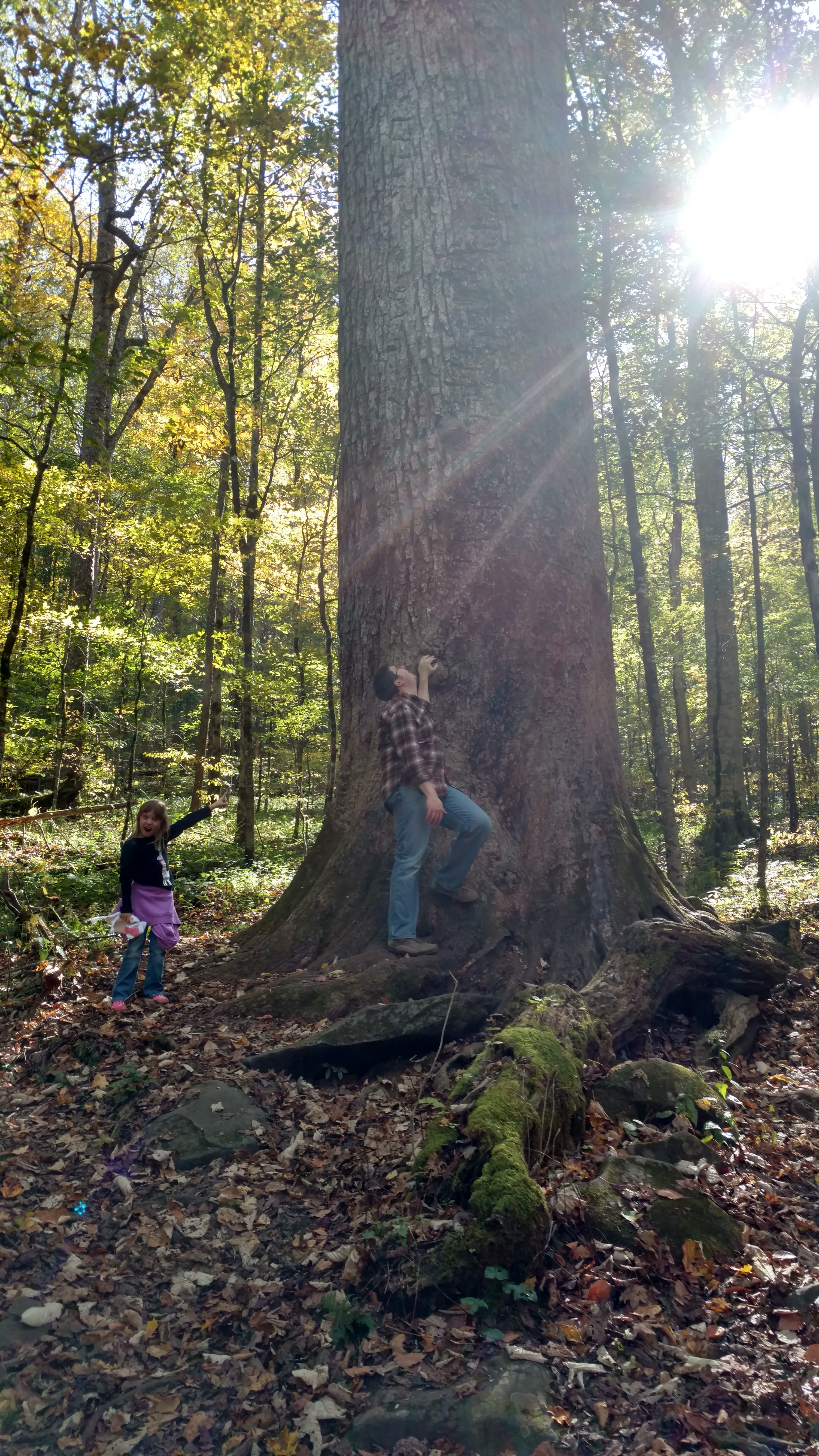
Some years ago, the property owner allowed for a hiking easement, but I’ve not found the time to check it out. Most hikes with family opt for more easily obtained objectives. This Christmas break, though, my sister, my brother-in-law, and I decided to give it a go. As a bonus, we even talked my dear wife and our oldest two girls into tagging along. Were we ever in for some fun.

The trailhead, such as it is, is a metal farm gate on the southbound side of Meat Camp Road, across from a gravel pull-off just big enough for three or four cars. It’s about 1/2 mile past the entrance to Elk Knob State Park (which is a worthwhile hike in its own right). There are several gates on the same side of the road, so look for the one with the “Practice Leave-No-Trace Hiking” sign on a telephone pole next to it. A quick hop of the gate (if it’s closed) and you’re off.

The first mile or so is a wide (if quite steep) unpaved road—whether for logging or access to utilities. The steady ascent moves between woods and fields, and opens up some fine views of nearby peaks.

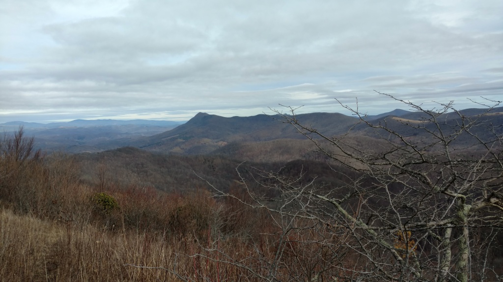
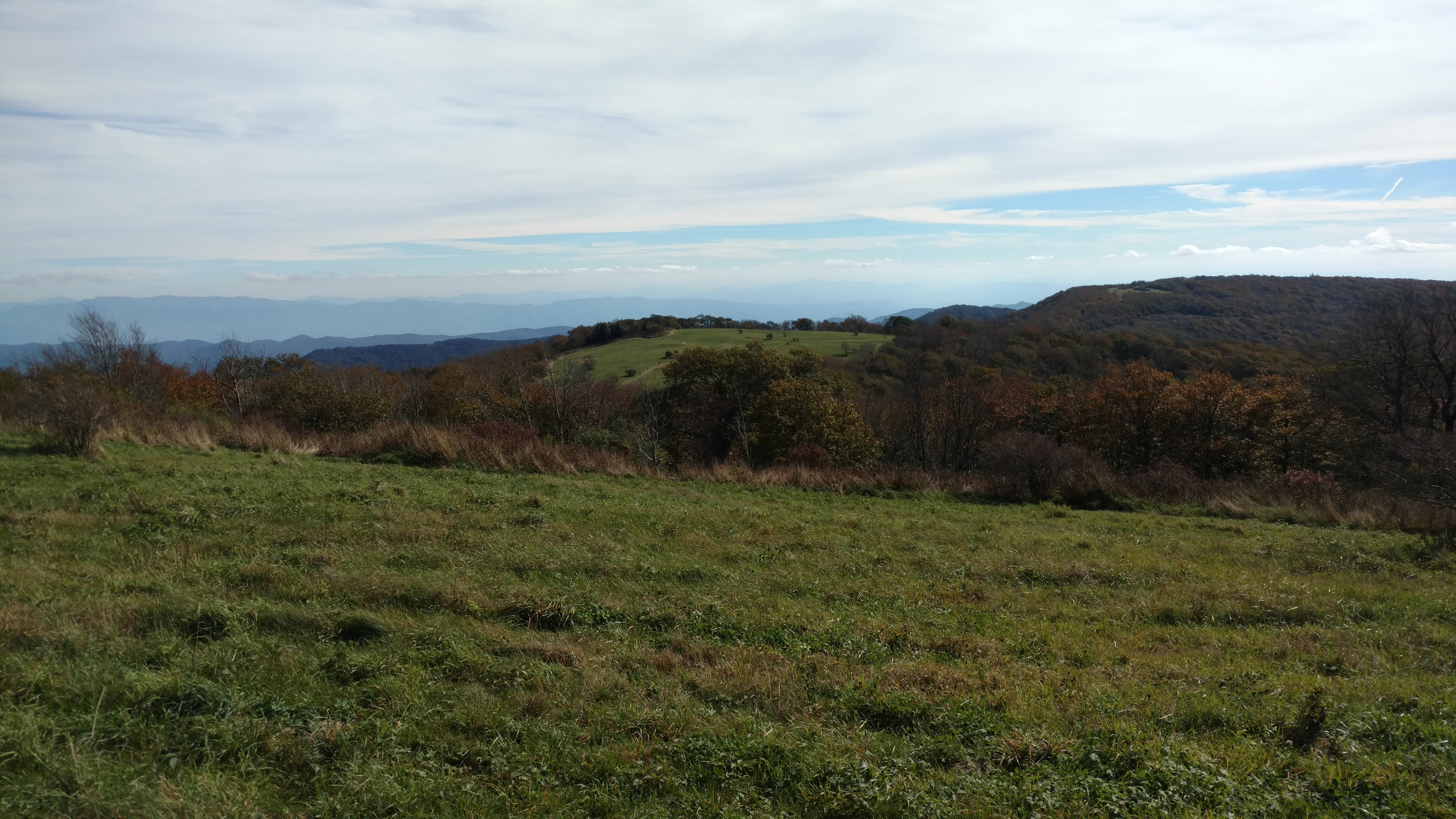
After nearly 700 feet of elevation gain, the trail splits off the road and becomes excruciatingly vertical, navigating a narrow way through grass, rocks, and mud. Passing some impressive cliffs, the sweeping view to the north and east begins to take shape—taking in much of Ashe County and on up to Mount Rogers and Whitetop in Virginia.

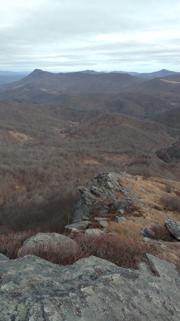
The ascent slows at a sub peak, with a semi-level stretch along a narrowing rock-ledged ridge. At this point, off to the right, you might notice a road and parking lot, which is part of a failed housing development accessed through Tennessee (at this point, the ridgeline—and trail—follows the state line). I think you can access the trail from there, making a shorter approach. The easygoing stops abruptly when the trail appears to dead-end into a small cliff. We made the mistake of following some trodden ground to the right, but the trail actually goes straight up in a tough scramble (because it is private property without an “official” or maintained trail, the whole route is unblazed).

Because of the error, we ended up sidehill in thick woods as the false trail petered out. Rather than going back, we made a tree-to-tree sprint back to the top of the ridge to re-find the trail and made it to the north sub-summit for lunch. The view west and south (encompassing the Holston Valley, Grandfather Mountain, the Roan Mountain massif, and the Black Mountains) opens up. On this well warmer than average day, the wind was low, and ravens were circling the cliffs (likely eying my kids’ cheetos).

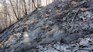
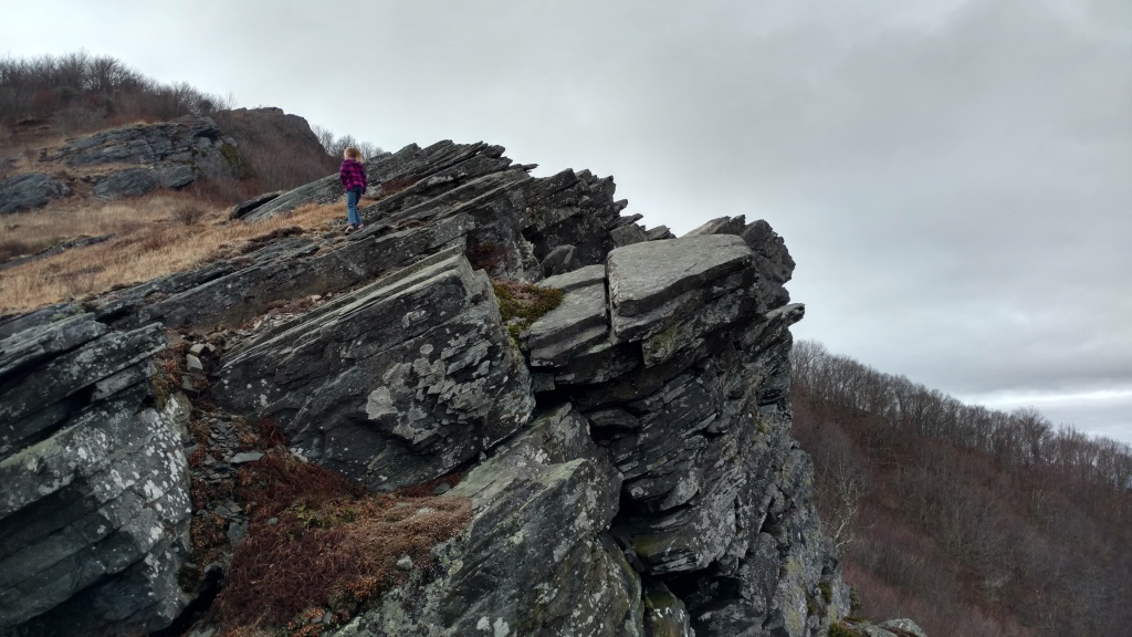
After a knee-busting descent down a stair-step of amphibolite outcroppings, a look back shows the difficulty of what you’ve accomplished.

The rest of the descent back to the road portion is a nice mix of deft, ACL-preserving maneuvers through leaves and mud and step-downs with some good, old-fashioned butt-busting slides. Once you hit the walkable section it’s a quick hustle back to the car. The whole descent from the summit barely took 30 minutes (covering nearly 2 miles). An afternoon well spent, with views as good as I’ve seen anywhere. My oldest daughter said the rock climbing work was harder than what we did at Joshua Tree this summer, which did my Carolina heart proud.

Thirty-Five

After Mary Oliver

thirty-five years
the mountains and forests have
called loudly my name and I have tried
      to follow their forceful

impetus running toward
looming hills looming woods
with leaps and strides
      looming closer till

not one day
was less to me than inundating
discursive full of wonder
      its pale dawn showing

through the curves of the fog
behind condensated windows
all the misted host of the Blue Ridge
      thirty-five

and again this morning as always
I am freed as the thought comes forth
small yet delightful and I am feeling
      that language

is not like a river
is not a tree is not mountains but
is the thing pulling them out of the void
      wholly continually

from eternity and I
breathe back humble metered praise.

Into the Woods: Big Frog

I’m a self-confessed fan of winter hikes. Occasionally, however, I go hiking when it’s actually cold.

To those of you not from the South who think “cold” means 45 degrees to us down here, I have a word for you: A-L-T-I-T-U-D-E. Turns out, no matter how far south you go, if you go up high enough, the weather changes. This is why there are snow-capped mountains in Ecuador and ski resorts in SoCal. Though the Mountains in the Southeast don’t quite compare to those feats of skyscraping, you’d be amazed at what a 2,000 – 3,000′ climb does for your thermometer.

IMG_20190121_093315845.jpg

Stylish, I know.

Knowing this full-well, I set out this weekend for one of our near-neighbor peaks—Big Frog (so called because of its supposed resemblance to a sleeping amphibian in profile. Make of this what you will)This week marked the first real cooldown of the winter so far. The morning of the hike, it was 18 degrees (F) at home in Chattanooga. My nose and frozen Camelback valve jointly guess at a temperature of around 5 once I reached the summit (4,224′) in early afternoon. Typically, I shed layers through the day, even as I ascend. This time, I had to put them back on.

This is a small inconvenience in the grand scheme of things. Hiking in the cold has tremendous benefits. First is the obvious joy that is the absence of insects, arachnids, and reptiles. Second, as any frequent traveler in the Southern Appalachians knows, trails around here get very muddy. Set out when the mercury drops, though, and it’s all crisp and crunchy. Third and most impressive, is that—when the conditions are right—the payoff of your effort can be a beauty that defies description (and doesn’t respond too well to efforts to photograph it either).

Rime is something that almost has to be witnessed to be believed. Frost curls are equally impressive, but you don’t have to go hunting for these extrusions solely at altitude.

There is plenty else to catch the senses beyond the weather. There are huge white pines on side slopes, and stout, spring-fed oaks and tulip poplars in north-facing coves. There is a tunnel through an ancient slick of rhododendrons just below the summit that is alone worth the hike. This time of year, there are periodic views through gaps in the trees that extend from the Unicoi Mountains to the northeast all the way to Lookout Mountain and the Cumberland Plateau to the southwest. Best of all, though, is the silence. Big Frog is isolated. It’s got a topographic prominence of 2,480′; it’s in a federally designated wilderness area, nearly 10 miles from the nearest paved road; it’s a tough enough hike to keep crowds to a minimum. At the top, you have to strain to hear anything but the occasional wheeze of the wind.

As to the trail itself, the quickest route to the summit is via a combination of trails starting with USFS trail #64 (aptly named the “Big Frog Trail”), which cover 5.5 miles and about 2,200 ft. of elevation gain from the trailhead off FS road 221. The middle 2 miles of the path does most of the climbing in a quick assault on the north ridge of the mountain after a gentle mile-and-a-half on an old logging road at the beginning. The last two miles join the Benton MacKaye Trail for a steady, smooth ascent, including a nearly flat half-mile to finish.

IMG_20190121_124227648.jpg

Winter is not without its difficulties

It’s been nearly five years since I’ve done this one (and that time was in a driving summer downpour), and I’d forgotten what a good stretch of the legs that middle section is—a consistent 10-12 % grade. Some of the upper portion is narrow, slippery, and has a strong cross-trail tilt in places.

Overall, though, this is an accessible approach to a hidden gem close to home, well worth anyone’s time.

Into the Woods: Unicoi Mountains

If you’ve read any of my other hiking posts, you’ll notice that I have an unabashed fondness for “special places”—spots where quirks of terrain, climate, or human use (and abuse) of land combine to create a niche environment not easily replicated. (Full disclosure, the USFS has started using this term as an official designation for certain spots, but I’m going to keep it, too.) Bonus features of such places include a relative anonymity and inaccessibility, leaving me to enjoy them in quiet solitude as often as not.

Most of my favorite such spots are far from home, closer to where I grew up than to where I live now, but I’ve been exploring.

Huckleberry Knob
One location that has become near and dear of late is the Unicoi range in the far southwest of the Appalachians on the NC/TN line. The only road through here is the Cherohala Skyway (a state route named in portmanteau of the two national forests it passes through—Cherokee on the Tennessee side, Nantahala in North Carolina), a steep, winding 43 mile traverse from Tellico Plains to Robbinsville. Mercifully, for my purposes, though this route is extremely popular with motorcyclists, most of the traffic is there to test the curves, not to park and walk.

Along this route, I typically opt for a hike at Huckleberry Knob. At 5,560, it’s the highest peak in the Unicois, and the farthest west you can be that high above sea level until you get to the Black Hills and far west high plains. Again, though there are better overall hikes elsewhere, this one has become a favorite by virtue of proximity. It’s only a 2 hour and 10 minute drive from Chattanooga. In addition, as our crew has multiplied, finding places that adults and kids can enjoy together is important.IMG_20181019_150330396

Among the features Huckleberry Knob boasts are:

  • Acres of grass, allowing for 360-degree views and lots of cartwheels (if you bring your kids)
  • A bona-fide grave at the summit (from a logger who decided to walk over the mountain to get home for Christmas, got drunk, and froze to death in a blizzard, back in 1899).
  • Wide, relatively low-impact trail from parking to summit. Even our four-year-old made it all the way to the top (+/- 3 miles total).
  • The aforementioned grass is great for picnics, or frisbee, too.
  • It’s not hot up here, making for a perfect summer afternoon getaway.
  • Plenty of flora and fauna to satiate your inner naturalist (including the southernmost Fraser firs I’ve ever found).

It’s a place we’ve been coming back to often, even making it an autumn tradition to quest for the peak fall color (which arrives there long before it makes it to the lowlands of the Tennessee Valley. In sharing it with you, I trust you won’t abuse the place.

Joyce Kilmer Memorial Forest
Once you’ve committed to the Skyway, you may as well go all the way to the eastern end and visit the Joyce Kilmer-Slickrock Wilderness. We typically tack this on when we head that way.

It’s a bit odd for a forest to be named after a person, but the USFS thought Kilmer worthy of the honor. The popular journalist and poet, best known for his work “Trees“, was overcome with patriotic zest and joined the Army during World War I. After this endeavor resulted in his death 100 years ago at the second Battle of the Marne, his local veterans association petitioned that a patch of forest be dedicated to his memory. In the late 1930s, the USFS at last selected a 3,800-acre unlogged cove of old growth woodland along Little Santeetlah Creek as the wordsmith’s living tombstone.

Before you dismiss this as so much kitsch, I should point out that this patch of woodland should absolutely have been preserved, under any pretext necessary. Some of the tulip poplars here clock in at over 500 years old, and their height and girth are the closest thing many Easterners will see to the Redwoods.

In former times, these giant polars were joined by Eastern Hemlocks of similar size, but the hemlock wooly adelgid has done its dirty work here as in so many creekside coves throughout Appalachia. Moreover, a series of disasters have taken their toll here in recent years. In 2011, an exceptionally rare tornado touched down here, taking out several grand specimens. Goaded on by the storm debris and a later extensive drought, a wildfire torched the eastern slope of the forest in 2016, leaving the forest much-altered from when I first visited in 2007.

Even still, some of the largest trees remain untouched, and they never fail to inspire. The big’uns are accessible by a 2-mile figure-8 loop. It’s muddy, sometimes narrow, but never terribly steep. I’ve taken kids all the way around with minimal difficulty.

IMG_20171027_145845057_HDR

Both these spots are within day-trip range of Chattanooga, Atlanta, Knoxville, Asheville, or Charlotte, but the motion-sickness-inducing road access keeps crowds down to the truly dedicated. If you’ve got more time to spend, there are several fine USFS and private campgrounds lining nearby Santeetlah Lake.

If, to paraphrase Kilmer, hiking blogs are made by “fools like me,” then you owe it to yourself to come up to the Unicoi range and see some of the more impressive things God has made to grace our corner of the universe.