Into the Woods: Seven Islands Birding State Park

With gathering indoors but a happy memory these days, it’s a great time to get out and hike. We’ve done our fair share over the past few months, but it’s been a while since I’ve posted any trip reports. Some of this is because it’s been a family affair, and carrying a 2-year old limits both how far you can walk and how many pictures you can take while doing it. We’ve hit some of our old favorite spots (Huckleberry Knob), some new ones (Conasauga Snorkel Hole), some farther afield (Hawksbill Mountain in Linville Gorge Wilderness), and lots of walks close to home (Tennessee Riverpark, Chickamauga Battlefield, and Enterprise South Nature Park).

A couple of weeks ago, though, I had occasion to be in Knoxville, and the weather coaxed me to spend some time outdoors. I don’t care much for hiking in the lowland South in the summer—too hot, too humid, too many bugs, snakes, and poison ivy. That week, though, a fading tropical storm working its way up the East Coast pulled some drier, cooler air around its west side, making July in East Tennessee a trifle more bearable for a couple of days. When you’ve lived in this part of the world for a few decades, you know better than to let those opportunities slip by—it might be months before another really nice day comes along.

I opted to take advantage of this particular day to check out a spot I’ve seen signs for but never visited—Seven Islands Birding State Park. I’d read that it had access to the French Broad River, so I went initially with the aim of fishing, but found a lot more.

For starters, this place is beautiful. The River defines the space, looping around the whole park, and there is a very nice footbridge connecting the main path to one of the islands. Due to its open, meadowy nature, the views are also impressive. The Great Smoky Mountains rise just a few miles south of the park, and from one of the hilltops, the whole ridge (including Mount LeConte) opens into view. There are also a few ponds and marshes dotting the area.

Beyond that, the park lives up to the “birding” part of its name. There are birds everywhere. In just a few hours, I saw hawks, herons, and ducks, along with a bevy of songbirds like goldfinches, indigo buntings, yellow-breasted chats, several different warblers, and other more common species. I heard, though did not see, a few bobwhite quail, too. This was a treat. It was so common to hear their tell-tale whistle in rural Georgia in my childhood, but populations of these ground-dwelling birds have plummeted in recent decades due to habitat loss. In fact, preservation of prime quail habitat is the park’s key goal. There was plenty of non-bird wildlife, too. I saw dozens of deer, hundreds of rabbits, bullfrogs, bugs, a muskrat, and a field mouse.

I did fish (as is often the case, to no avail—with either flies or spinning lures), but the evening light lured me to spend a couple of hours exploring the trails, most of which are wide-mown paths through a tallgrass prairie ecosystem. This plant life was just as impressive as the animals. In a part of the country that is largely comprised of forests, farms, and urban development, it’s not often we get to see native grasses and field plants have their day. I’ve read that pre-colonial indigenous land management practices made extensive use of fire and other methods to cultivate Southeastern prairies as way to increase herds/flocks of game, but these practices haven’t been preserved, leading to a false ideal of “wilderness” that actually eliminates crucial habitat. This little state park is a testament to the wonders of restoration.

I probably rambled about 5 miles over the course of the afternoon, but barely scratched the surface of available trails. I’ll be back, and you should check it out, too. The park is just 5 minutes off I-40 (at exit 402), but a world away.

Into the Woods: Snake Mountain

When my family moved to North Carolina, in the summer of 1998, I was fourteen with an endless imagination for the adventures these hazy blue mountains would hold for an erstwhile Georgia flatlander. I moved away after a short while (to Dayton, Tenn., for college in 2002, and I’ve lived in Chattanooga since 2006), but these hills have always felt like home. Fortunately, my parents still live in the same county, so I get to come back and stay often.

Of all the mountains, perhaps none captured my fancy quite like Snake Mountain. It was due north from the back deck of the house we first lived in up there, its silent, volcano-like visage staring at me every morning. Unlike many other peaks around the area, it was also inaccessible—private property with no marked trail or easy access to its 5,555′ rock-strewn summit.

Some years ago, the property owner allowed for a hiking easement, but I’ve not found the time to check it out. Most hikes with family opt for more easily obtained objectives. This Christmas break, though, my sister, my brother-in-law, and I decided to give it a go. As a bonus, we even talked my dear wife and our oldest two girls into tagging along. Were we ever in for some fun.

The trailhead, such as it is, is a metal farm gate on the southbound side of Meat Camp Road, across from a gravel pull-off just big enough for three or four cars. It’s about 1/2 mile past the entrance to Elk Knob State Park (which is a worthwhile hike in its own right). There are several gates on the same side of the road, so look for the one with the “Practice Leave-No-Trace Hiking” sign on a telephone pole next to it. A quick hop of the gate (if it’s closed) and you’re off.

The first mile or so is a wide (if quite steep) unpaved road—whether for logging or access to utilities. The steady ascent moves between woods and fields, and opens up some fine views of nearby peaks.

After nearly 700 feet of elevation gain, the trail splits off the road and becomes excruciatingly vertical, navigating a narrow way through grass, rocks, and mud. Passing some impressive cliffs, the sweeping view to the north and east begins to take shape—taking in much of Ashe County and on up to Mount Rogers and Whitetop in Virginia.

The ascent slows at a sub peak, with a semi-level stretch along a narrowing rock-ledged ridge. At this point, off to the right, you might notice a road and parking lot, which is part of a failed housing development accessed through Tennessee (at this point, the ridgeline—and trail—follows the state line). I think you can access the trail from there, making a shorter approach. The easygoing stops abruptly when the trail appears to dead-end into a small cliff. We made the mistake of following some trodden ground to the right, but the trail actually goes straight up in a tough scramble (because it is private property without an “official” or maintained trail, the whole route is unblazed).

Because of the error, we ended up sidehill in thick woods as the false trail petered out. Rather than going back, we made a tree-to-tree sprint back to the top of the ridge to re-find the trail and made it to the north sub-summit for lunch. The view west and south (encompassing the Holston Valley, Grandfather Mountain, the Roan Mountain massif, and the Black Mountains) opens up. On this well warmer than average day, the wind was low, and ravens were circling the cliffs (likely eying my kids’ cheetos).

After a knee-busting descent down a stair-step of amphibolite outcroppings, a look back shows the difficulty of what you’ve accomplished.

The rest of the descent back to the road portion is a nice mix of deft, ACL-preserving maneuvers through leaves and mud and step-downs with some good, old-fashioned butt-busting slides. Once you hit the walkable section it’s a quick hustle back to the car. The whole descent from the summit barely took 30 minutes (covering nearly 2 miles). An afternoon well spent, with views as good as I’ve seen anywhere. My oldest daughter said the rock climbing work was harder than what we did at Joshua Tree this summer, which did my Carolina heart proud.

Into the Woods: Southern California

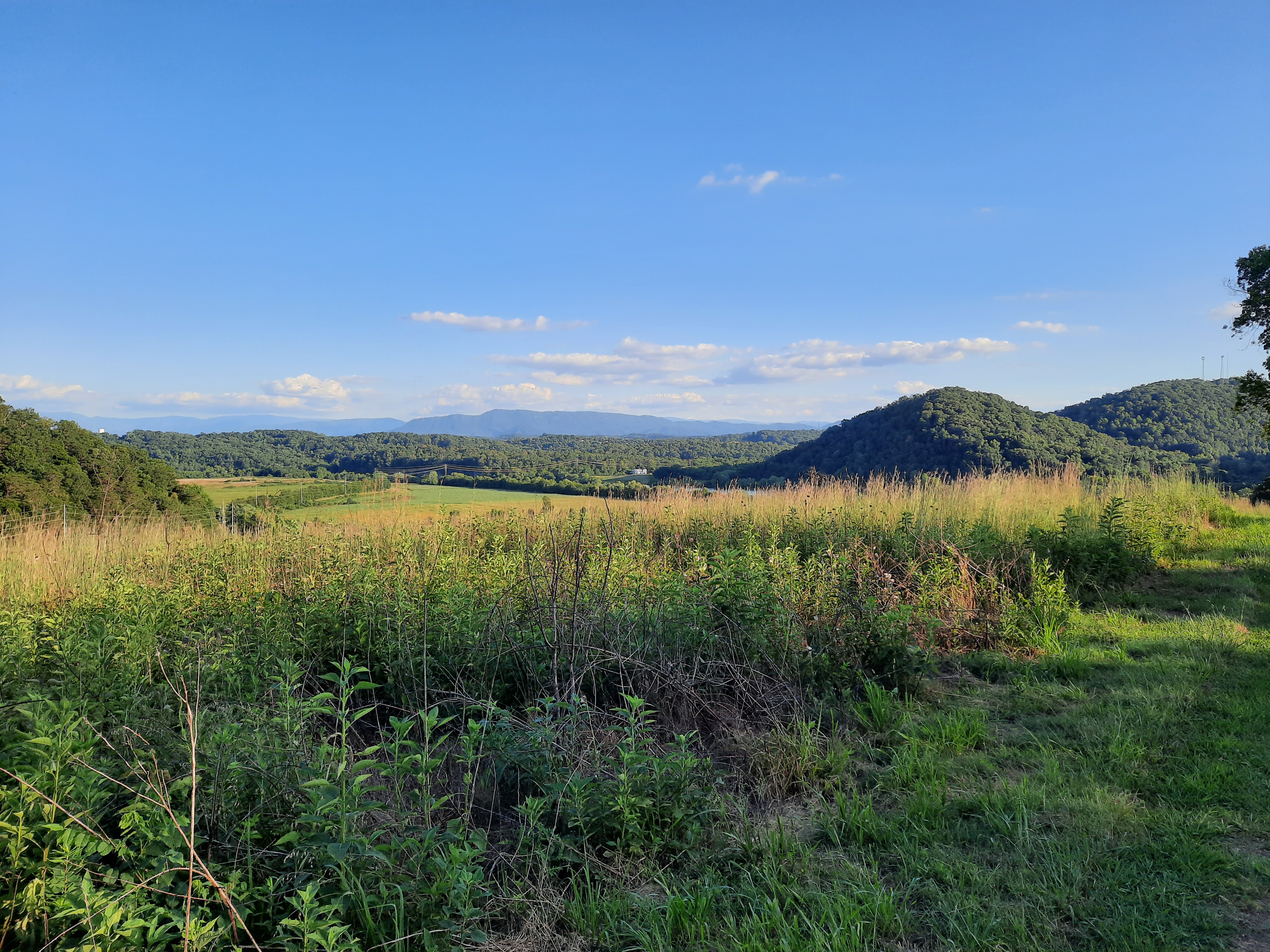
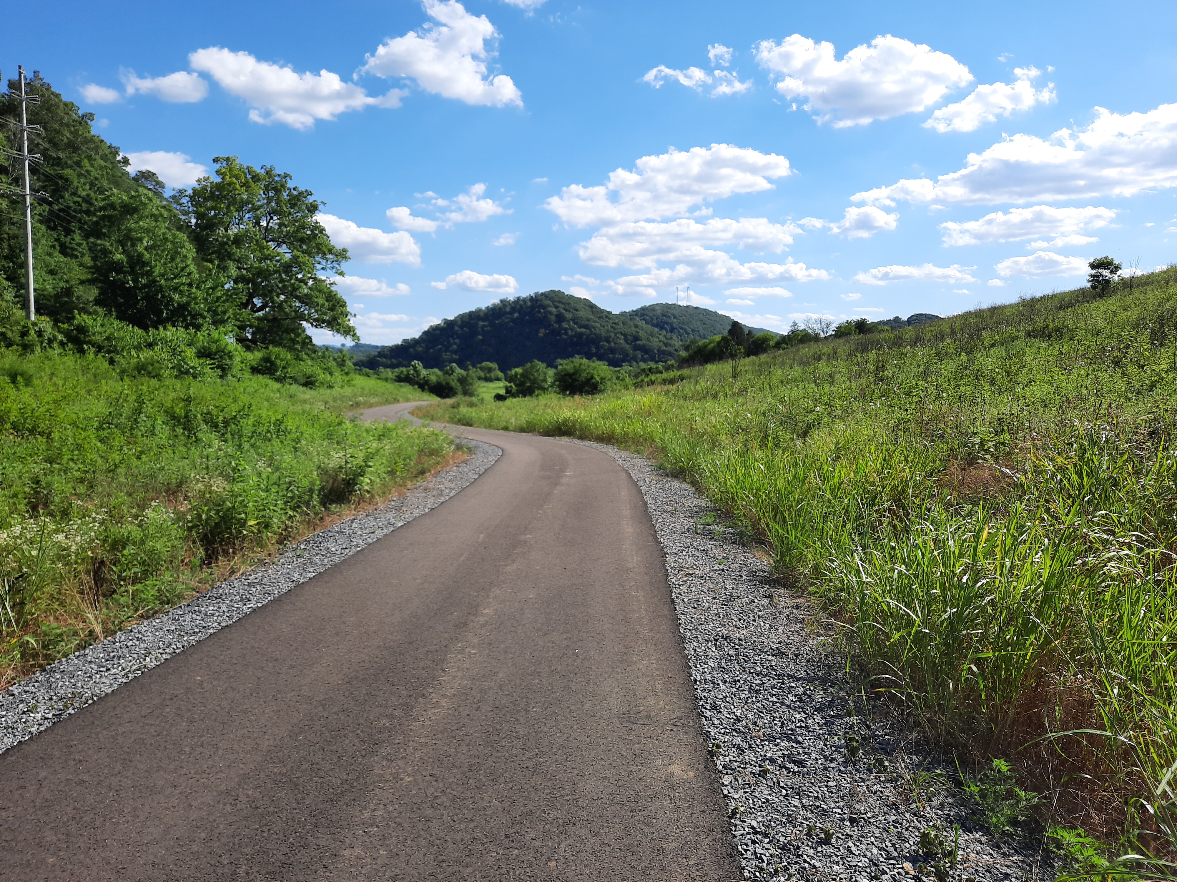
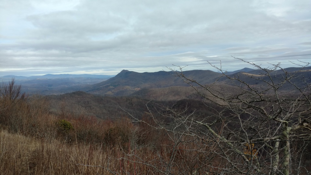
If you read much here, you know that I really like to go hiking, mostly within my context of the Southern Appalachians and the Cumberland Plateau (TN, NC, GA). Sometimes I get to go farther afield, though.

A few years ago, I got the idea to do a big daddy-daughter trip with each of my kids (4 girls) when they turned 10. I set the parameters pretty widely—anywhere within the continental U.S.—and figured I’d let each of the girls’ ingenuity and personality be expressed by their choice of destination. Did that ever come through on our first try!

My oldest turned 10 in July, and stretching the outer limits of my boundaries, chose to visit Channel Islands National Park. You see, she’d read Island of the Blue Dolphins, and was quite captivated with Scott O’Dell’s rich description of place. But still, her answer to “anywhere in the continental U.S.” was “an island off the coast of California!” You get extra points for audacity, though, so we set out West for six days in mid-June.

To make the most of our time and travel expenses—for the record, flights from ATL-LAX on Delta are typically affordable—we spread the net a bit wider to catch several other national parks (Joshua Tree, Sequoia, and King’s Canyon) to get a feel for many of Californias wildly divergent eco-regions. This was made possible in part by the generous  “Every Kid in a Park” program from the NPS. In each place, we did several short hikes, but I’ll highlight the best ones below.

Channel Islands: Scorpion Cove to Smuggler’s Cove
You have to want to get to the Channel Islands. Arriving as we did, in the midst of “June Gloom” (when the slowly warming Pacific coats the coast with a “marine layer” of clouds and drizzle for much of the day), there’s no indication, standing on the wharf in Ventura, that there are islands out there in the mist. In faith, you pile into a small-ish boat for the 20+ mile cruise to Scorpion Anchorage on Santa Cruz Island. After an hour and a half or so of bobbing and splashing (and, if you’re lucky, some friends along the way), you make debark onto a small metal pier and into a new world.

We took gear and in order to camp, which provided its own set of adventures. The Scorpion Cove campground (in a valley reclaimed from the headquarters of a cattle ranch from pre-national park days), is small, holding 20 or so sites, with limited sources for drinking water, no plumbing, no electricity, and no fires allowed. All well-traveled campgrounds have animal visitors (people mean food, as all good critters know), but I’ve never seen the level of boldness we experienced from the island foxes, scrub jays, and ravens in seeking a morsel.

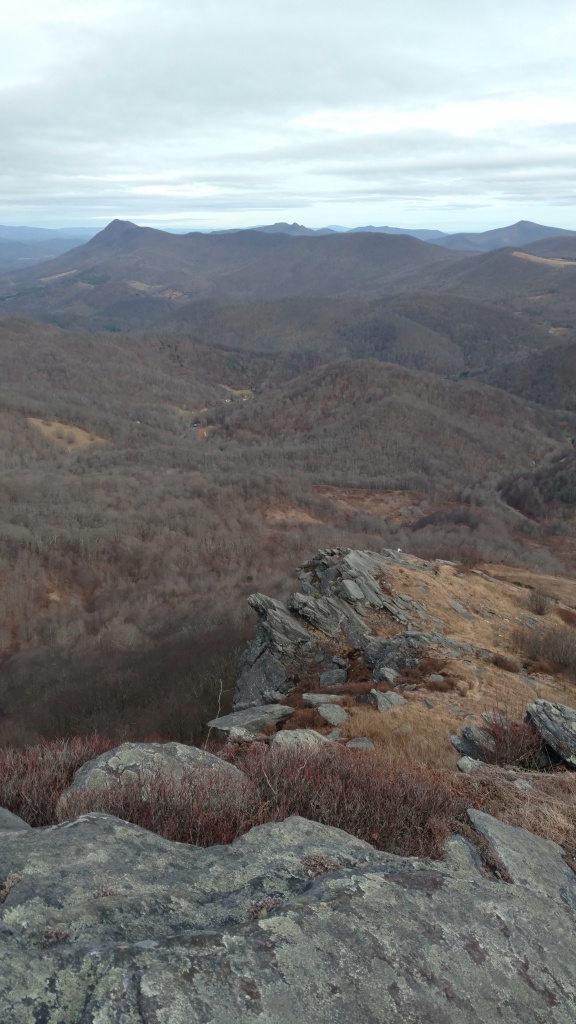
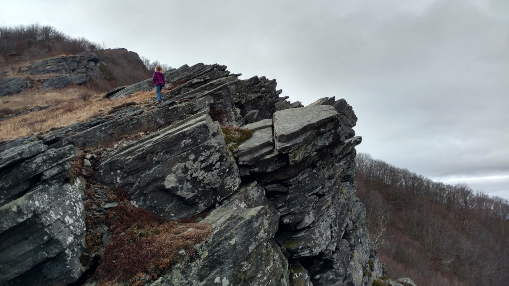
After a couple of trips up to Cavern Point (<1 mile walk to the cliffs above the campground) to take in the plant life and sunset, we settled in for the darkest, quietest night of camping I’ve experienced in a while. The next day was cool and cloudy, but as the sun poked through, we broke camp and set out for the Smugglers Cove Trail.

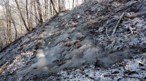
Santa Cruz is a large, long, mountainous island, and the main NPS property is confined to the northeastern tip. Our trail cut across that section, going from sea level on one side of that promontory, up to roughly 700′ in the foothills, then back down to sea level on the southeast coast. The trail is good—wide and well kept, probably an old ranch road—but steep in several places. Word to the wise, we also learned that, once the clouds break up, there is no shade along the route, and these two tree-accustomed Easterners got deeply sunburned.

The remoteness of the park, difficulty of the trail, and the fact that it was a weekday meant that we encountered few other hikers. The terrain shifts made it feel like going from a tropical paradise to the middle of nowhere in Nebraska to a Mediterranean coastal village. There were plenty of interesting flowers and grasses, and an assortment of animals ranging from birds to butterflies to ground bees to harbor seals. Sweeping views of the island (and neighboring islands and the mountains on the mainland) and having a huge gravel beach all to oneself were well worth the walk, though I don’t think my daughter was any too happy with the climb on the return trip. Still this was one of the most interesting hikes I’ve done, and we both boarded our return boat scheming plans to come back someday.

This slideshow requires JavaScript.

Joshua Tree: Hidden Valley Nature Trail
Back on the mainland, we treated ourselves to fish tacos, and then made the trek across the L.A. metro to Palm Springs for the next leg of the trip, this time opting for a hotel with a pool instead of camping. In contrast to the cool, moist coastal air, it was 95 degrees in the desert…when we arrived at 10 p.m.! This, plus the sunburns we were already nursing made the prospect of hiking less attractive, so we opted to lay low until late afternoon.

Fortunately, the bulk of Joshua Tree National Park sits on a plateau, 4-5,000 feet above the sea-level-and-below terrain of the Coachella Valley. While the lowlands baked at nearly 110 degrees, it was only 88 or so in the park. Still without much tree cover, it was hot, so we kept our hike short, opting for the Hidden Valley Nature Trail, a 1-mile loop along the park’s main road. There were more people afoot here, but Joshua Tree is more of a winter destination, so still not crowded by any stretch. The loop didn’t present any hiking challenge, but it was a fine spot to marinate in an otherworldly landscape of cacti, jackrabbits, lizards galore, the park’s eponymous “trees” (really a woody species of yucca), and climbable rock formations that could’ve been deposited from the moon.

After this, we drove to another spot for more intense climbing while we waited nighttime and cool temps and stars. As the day drew down, we joined a small crowd of others (and one slightly perturbed sidewinder) at Key’s Point on the west rim of the plateau to watch an unfettered, 180-degree sunset that seemed to last forever. Then, on the way back to our hotel we stopped beside the road to soak in the wealth of stars afforded by the desert and marvel at the nearly instantaneous 30-degree temperature drop.IMG_4453

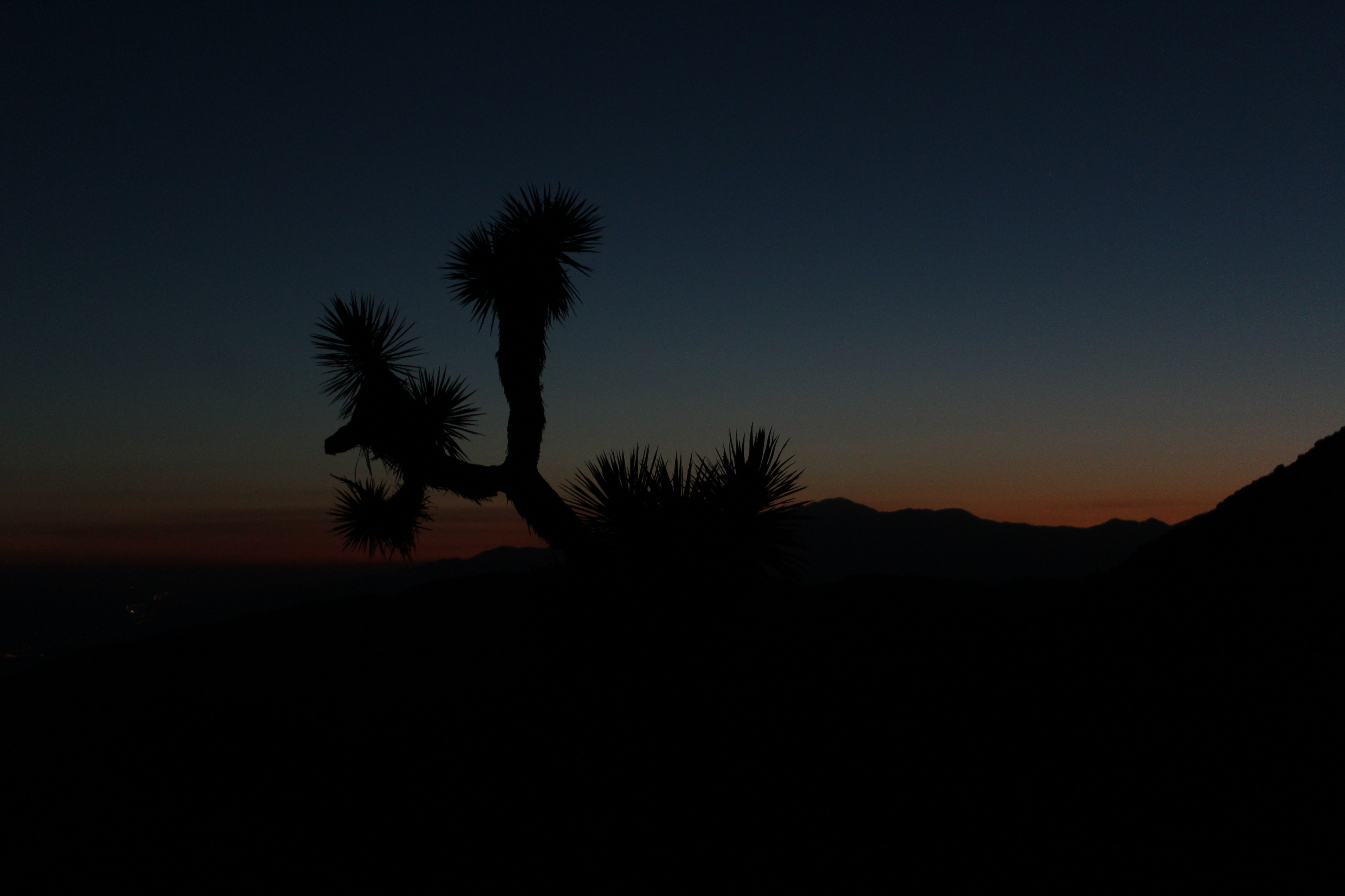
Of all the places we visited, I was initially least enthusiastic about Joshua tree, but that just means it was the place that surprised me most.

Sequoia: Tokopah Falls Trail
Nothing makes one long for the cool woods of high mountains like a couple of days in the desert, so to close out our trip, we headed north through the central valley and up to the high Sierras and Sequoia National Park. The trees are the stuff of legend, and it’s easy to understand the universal appeal, but that also means that this gave us our first taste on this trip of the standard NPS rigmarole of crowded trails, not finding parking spaces, and people from every corner of the world vying for photos with General Sherman. Still, we had plenty of peace and quiet wandering the meadows and groves of big trees in the main section of the park. If you’ve been there, you know that being in the presence of these giants defies description. If you haven’t, just go sometime, and we’ll smile and nod about it together.IMG_4601

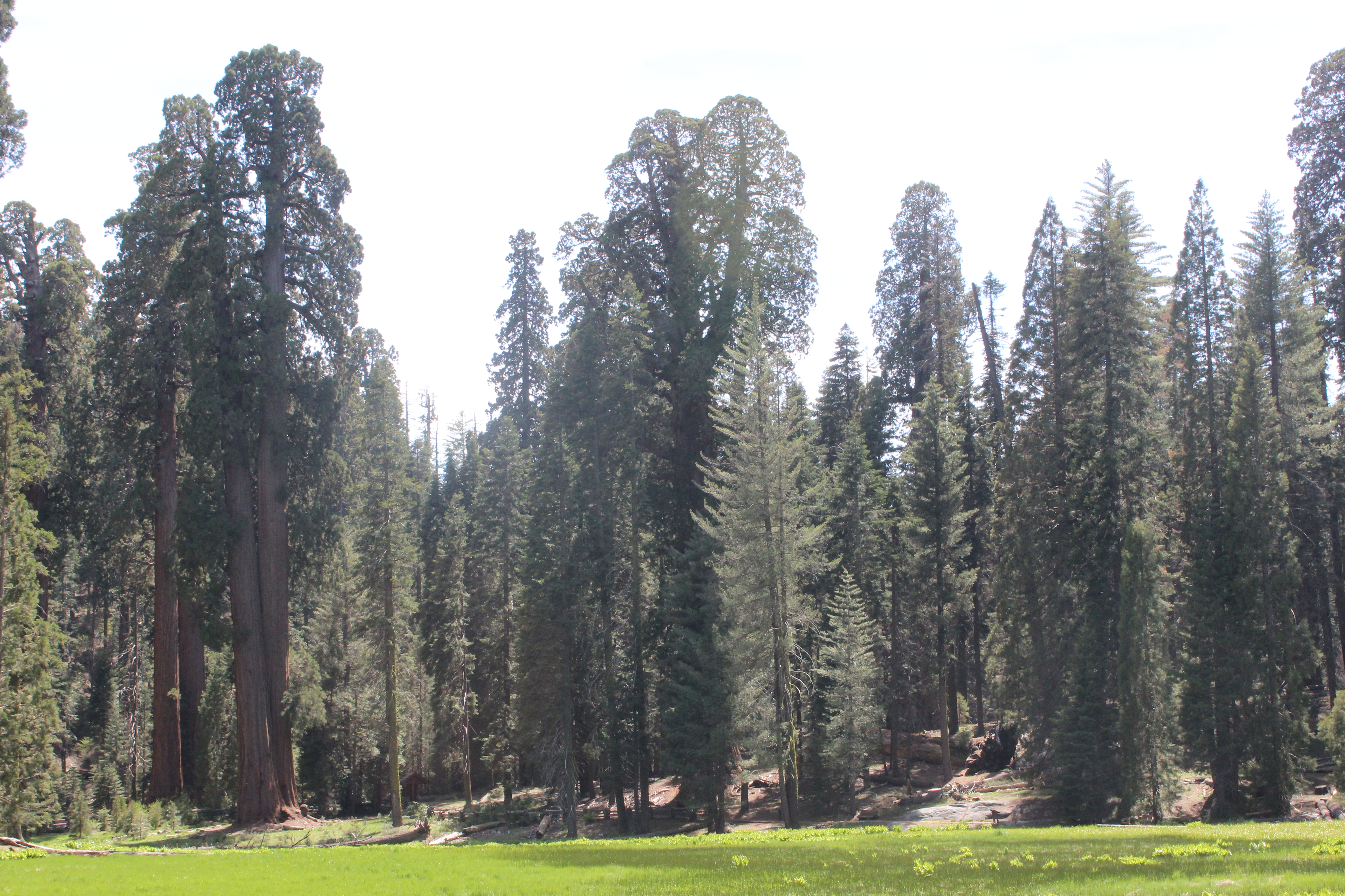
For our last night out west, we opted again for camping (I’m nothing if not cheap), and after exploring all day, we set up the tent at Lodgepole (N.B. – I booked this site 6 months in advance—for a Monday night!). From the campsite, we decided to add one more hike up to Tokopah Falls, a moderate 4-mile round trip following a fork of the Kaweah River up to the very edge of alpine tundra. The river was very full, and we were duly warned from any attempts at getting too close. IMG_4624

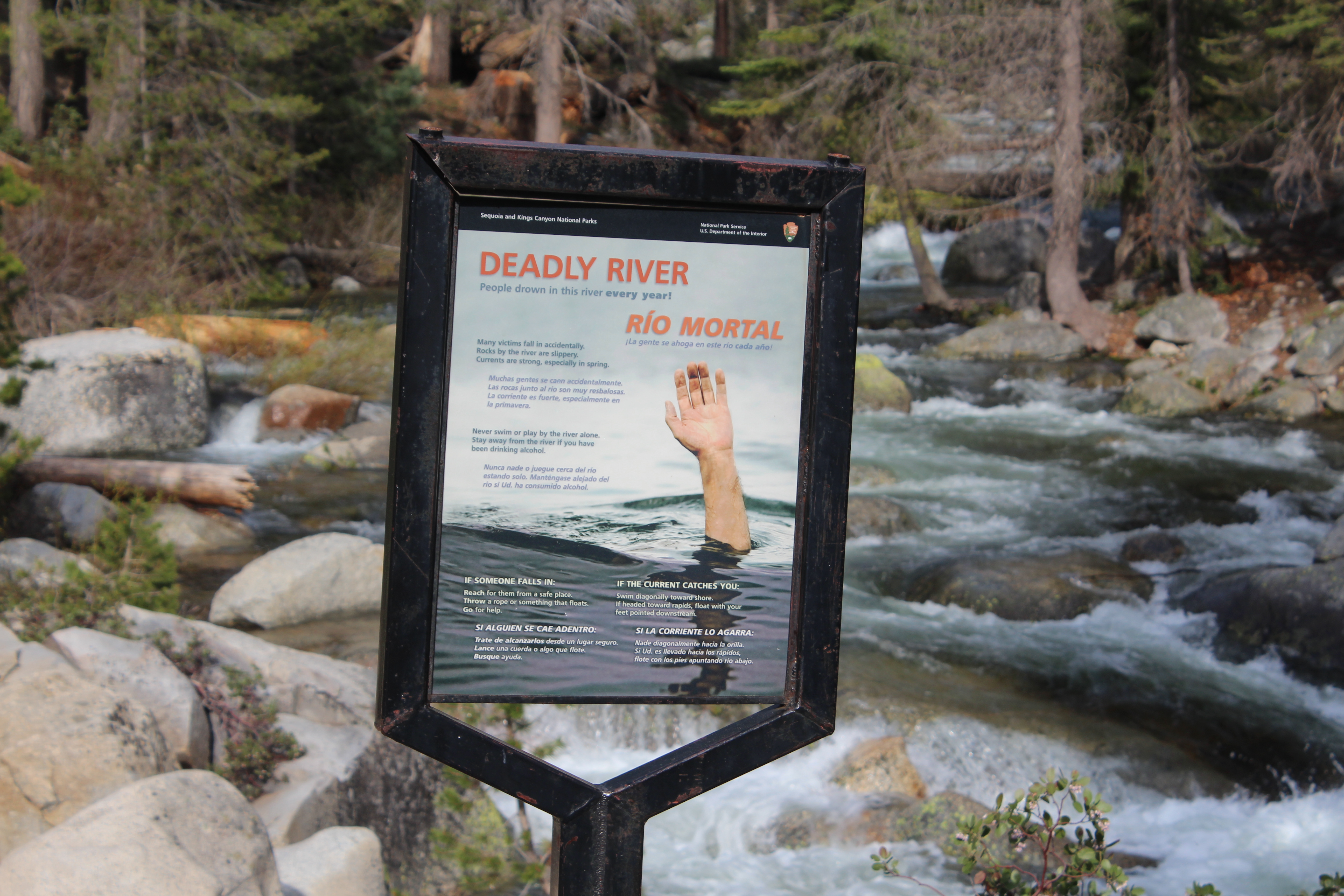
Most of the trail was well forested, but at 7,000 + feet, more with spruce, fir, pine, and cedar than sequoias. Here, in the shade, there was still ample snow, and the runoff from higher-altitude melting occasionally made the trail itself into a tributary of the river. About 3/4 of the way in, hikers coming the opposite direction warned us of a bear feeding on grubs in a trailside stump up ahead, but we never made his acquaintance. We did, however see some striking lizards and Steller’s jays and had a near-handshake with a yellow-bellied marmot.

This slideshow requires JavaScript.

At the end of the trail, in wide granite basin, is the falls, pouring out from the snowpack along the rim of the Sierra Nevada. Beautiful doesn’t begin to describe it, but it felt somehow as majestic as parts of nearby Yosemite, but more intimate somehow, closer. The wind falling into the valley from the snow above was reminiscent of standing below a glacier, and the sunset painted the rocks shades of pink that my camera couldn’t touch. The trip back in the rapidly chilling dusk was so quiet, you could, for a moment, forget you were in one of the most visited national parks and imagine it as it was first encountered.

On the long drive back to LAX after a cold night’s sleep, a less-than-ideal coin-operated shower, and a quick detour to see King’s Canyon, all this started to feel like a blur. But my daughter’s wonder (if you’ve met her, you’ll know that “speechless” is rarely an apt descriptor), even still when she looks at pictures, holds each trail as a moment in time that will keep its place in the memory banks.

Sure, California is crowded, expensive, and over-hyped, but it is truly lovely and well worth a visit. Just take some time to get off the road and see it up close and personally, and reap the rewards.

Into the Woods: Big Frog

I’m a self-confessed fan of winter hikes. Occasionally, however, I go hiking when it’s actually cold.

To those of you not from the South who think “cold” means 45 degrees to us down here, I have a word for you: A-L-T-I-T-U-D-E. Turns out, no matter how far south you go, if you go up high enough, the weather changes. This is why there are snow-capped mountains in Ecuador and ski resorts in SoCal. Though the Mountains in the Southeast don’t quite compare to those feats of skyscraping, you’d be amazed at what a 2,000 – 3,000′ climb does for your thermometer.

IMG_20190121_093315845.jpg

Stylish, I know.

Knowing this full-well, I set out this weekend for one of our near-neighbor peaks—Big Frog (so called because of its supposed resemblance to a sleeping amphibian in profile. Make of this what you will)This week marked the first real cooldown of the winter so far. The morning of the hike, it was 18 degrees (F) at home in Chattanooga. My nose and frozen Camelback valve jointly guess at a temperature of around 5 once I reached the summit (4,224′) in early afternoon. Typically, I shed layers through the day, even as I ascend. This time, I had to put them back on.

This is a small inconvenience in the grand scheme of things. Hiking in the cold has tremendous benefits. First is the obvious joy that is the absence of insects, arachnids, and reptiles. Second, as any frequent traveler in the Southern Appalachians knows, trails around here get very muddy. Set out when the mercury drops, though, and it’s all crisp and crunchy. Third and most impressive, is that—when the conditions are right—the payoff of your effort can be a beauty that defies description (and doesn’t respond too well to efforts to photograph it either).

Rime is something that almost has to be witnessed to be believed. Frost curls are equally impressive, but you don’t have to go hunting for these extrusions solely at altitude.

There is plenty else to catch the senses beyond the weather. There are huge white pines on side slopes, and stout, spring-fed oaks and tulip poplars in north-facing coves. There is a tunnel through an ancient slick of rhododendrons just below the summit that is alone worth the hike. This time of year, there are periodic views through gaps in the trees that extend from the Unicoi Mountains to the northeast all the way to Lookout Mountain and the Cumberland Plateau to the southwest. Best of all, though, is the silence. Big Frog is isolated. It’s got a topographic prominence of 2,480′; it’s in a federally designated wilderness area, nearly 10 miles from the nearest paved road; it’s a tough enough hike to keep crowds to a minimum. At the top, you have to strain to hear anything but the occasional wheeze of the wind.

As to the trail itself, the quickest route to the summit is via a combination of trails starting with USFS trail #64 (aptly named the “Big Frog Trail”), which cover 5.5 miles and about 2,200 ft. of elevation gain from the trailhead off FS road 221. The middle 2 miles of the path does most of the climbing in a quick assault on the north ridge of the mountain after a gentle mile-and-a-half on an old logging road at the beginning. The last two miles join the Benton MacKaye Trail for a steady, smooth ascent, including a nearly flat half-mile to finish.

IMG_20190121_124227648.jpg

Winter is not without its difficulties

It’s been nearly five years since I’ve done this one (and that time was in a driving summer downpour), and I’d forgotten what a good stretch of the legs that middle section is—a consistent 10-12 % grade. Some of the upper portion is narrow, slippery, and has a strong cross-trail tilt in places.

Overall, though, this is an accessible approach to a hidden gem close to home, well worth anyone’s time.